Discover the Gwydir Shire
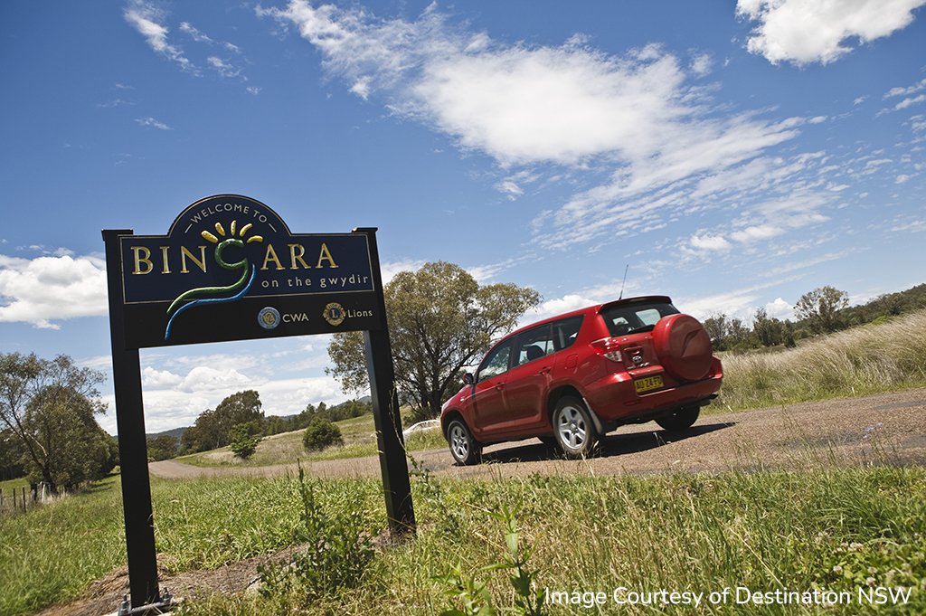
The Gwydir Shire is in the centre of the ‘Fossickers Way’ and encompasses a diverse landscape that is both picturesque and productive. The Gwydir Shire encompasses the larger towns of Bingara and Warialda as well as many small villages that offer a brilliant lifestyle.
The Gwydir Shire is renowned for the innovative farming practices its primary producers utilise such as satellite guidance systems and minimum tillage. Both Bingara and Warialda have amazing communications infrastructure and a great ‘can do’ attitude within the community, both of which are instrumental in making the Shire a wonderful place for a ‘tree-change’.
GWYDIR SHIRE STATISTICS
Population
Local Government Area: 4,910 residents
Bingara Township: 1,028 residents
Warialda Township: 1,130 residents
Housing
Bingara
Median House Price: $412,500
Median House Rental: $320 per week
Warialda
Median House Price: $290,000
Median House Rental: $340 per week
Employment
Top Three Occupation Groups:
- Managers
- Professionals
- Technicians and Trades Workers
Top Three Employment Sectors:
- Agriculture, Forestry and Fishing
- Helath Care and Social Assistance
- Public Administration and Safety
Property insights from realestate.com.au data for January to December 2025 for Bingara and Warialda. Other data sourced from Australian Bureau of Statistics - Gwydir Shire 2023, Bingara 2021 and Warialda 2021.
The Fossickers Way is one of the oldest and most picturesque touring routes in New South Wales and provides an alternative route between Sydney and Brisbane for those who enjoy an easy, more leisurely scenic drive. Escape the stress of hours on the road watching traffic, instead take your time and appreciate the magnificent, ever-changing scenery, a landscape which varies from steep wooded hills and native forest to wide fertile valleys fringed by a haze of blue ranges.
The drive is exciting and different and takes you through one of the richest gem areas in Australia and just like the precious stones found along its route, The Fossickers Way holds many treasures waiting to be unearthed - from buildings steeped in history to picturesque scenery and quaint villages where the personalities are as big as the sky overhead.
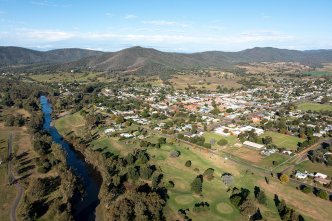
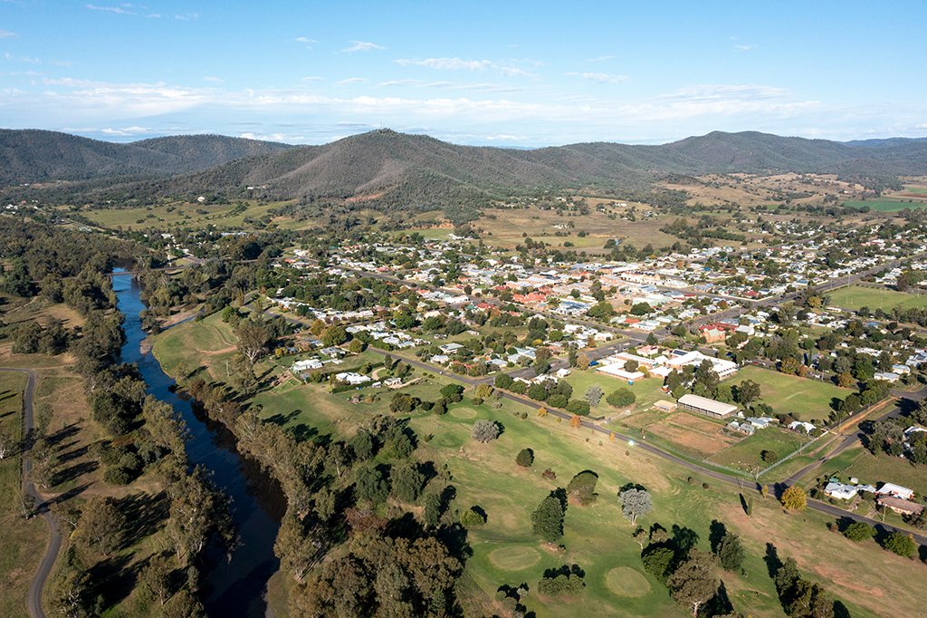
Bingara Township
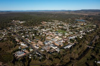
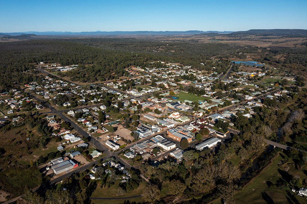
Warialda Township
The southern boundary of the shire is the Nandewar Range where the Gwydir and Namoi Valleys meet. The Horton Valley and Cobbadah District are home to some Australia’s most highly regarded beef cattle studs. These enterprising farmers use the latest artificial breeding and agronomic technology to produce beef of exceptional quality. Meat Sheep and merinos that grow high quality wool are also grazed in this area.
The Gwydir River enters the Gwydir Shire where it spills from the Copeton Dam and meanders in a westerly direction through the towns of Bingara and Gravesend. The Gwydir valley is well know for irrigated and dry land cropping as well as livestock production. In addition to the traditional crops of wheat, barley, oats and sorghum, there are olive groves, pecan nut plantations and freshwater fish farms in the Gravesend district.
Heading northwest from the timbered surrounds of the town of Warialda and the close-knit community of Coolatai, the countryside opens into an undulating vista of basalt farmland. This part of the Shire which include the villages of Crooble, Croppa Creek and North Star, is known
as the ‘Golden Triangle’. Farmers using advanced farming techniques, such as minimum tillage and satellite guidance systems, produce a variety of high yielding crops such as wheat, barley sorghum, maize, chick peas, canola and cotton to name just a few. This area also has several cattle feed lots which supply grain fed beef to the Australian domestic market and export markets throughout the world.
GWYDIR SHIRE CLIMATE
Bingara
| Average Maximum Temperature: |
26.2oC |
| Average Minimum Temperature: |
10.2oC |
| Average Yearly Rainfall: |
736mm |
| Average Days of Rain Per Year: |
60 |
Warialda
| Average Maximum Temperature: |
26.1oC |
| Average Minimum Temperature: |
8.3oC |
| Average Yearly Rainfall: |
687mm |
| Average Days of Rain Per Year: |
59 |
Australian Government Bureau of Meteorology, Bingara and Warialda 2026
Both Warialda and Bingara have Hospitals, Aged Care Hostels, Medical Centres, Caravan Parks, Swimming Pools, Preschools, Libraries, Tourist Information Centres. Warialda is the centre for the Council’s Technical Services functions. Bingara is the centre for the Administrative functions. The two centres are being linked through the use of sophisticated communications equipment to ensure that the amalgamations primary objective is achieved which is to save the existing employment numbers within each of the main urban centres of Warialda and Bingara.
TRANSPORT IN THE GWYDIR SHIRE
Public Transport
Driving from Bingara to:
Sydney - 564km in 6 hours and 40 Minutes
Brisbane - 468km in 5 hours and 45 minutes
Driving from Warialda to:
Sydney - 605km in 7 hours
Brisbane - 427km in 5 hours and 15 minutes
 Education in the Gwydir Shire
Discover the range of education and childcare options in the Gwydir Shire
Read More
Education in the Gwydir Shire
Discover the range of education and childcare options in the Gwydir Shire
Read More
 Employment Opportunities in the Gwydir Shire
Discover the opportunities in the Gwydir Shire for professionals, retail workers and tradespeople alike.
Read More
Employment Opportunities in the Gwydir Shire
Discover the opportunities in the Gwydir Shire for professionals, retail workers and tradespeople alike.
Read More
 Find Your Dream Home in the Gwydir Shire
Discover a home that is perfect for you to rent of buy in the Gwydir Shire
Read More
Find Your Dream Home in the Gwydir Shire
Discover a home that is perfect for you to rent of buy in the Gwydir Shire
Read More
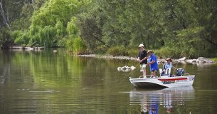 Recreation in the Gwydir Shire
The sky is the limit for the recreational activities to enjoy in the Gwydir Shire.
Read More
Recreation in the Gwydir Shire
The sky is the limit for the recreational activities to enjoy in the Gwydir Shire.
Read More
Would you like to know more about the Gwydir Shire?
You can find out more on the Gwydir Shire Council website or contact them for further information on 02 6724 2000, or by email at mail@gwydir.nsw.gov.au